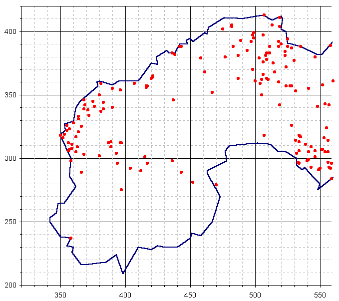
Each dot on this map shows the location of known mines. The clustering clearly shows the band of rich ores to be found to the north of St. Just, through Morvah, Zennor, Towednack and spreading into all of St. Ives and Lelant. There is a weaker band across the peninsular towards Penzance. What seems to be a separate band starts at the east of Ludgvan parish and continues strong and broad eastwards into St. Hilary, Perranuthnoe and St. Erth. The axes markers are the standard National Grid Reference for sheet SW.
