
I can help with all resources marked ![]() , copyright permitting.
, copyright permitting.
See also Books, Gazetteers, Photographs and Maps.
![[YES]](images/Ballred.gif) “Cornwall From
Space” is a glossy printed image at a scale of
1:200,000 from M-Sat Ltd. The photographs are taken from the
visible spectrum images of Landsat 5 at a height of 705.5km
with a resolution of 30m. Similar (the same?) pictures are
also available from a French company called
“Cornwall From
Space” is a glossy printed image at a scale of
1:200,000 from M-Sat Ltd. The photographs are taken from the
visible spectrum images of Landsat 5 at a height of 705.5km
with a resolution of 30m. Similar (the same?) pictures are
also available from a French company called ![[Off Site]](images/world.gif) IMSAT
(Link broken 9 Sep 2002).
IMSAT
(Link broken 9 Sep 2002).- The “Cornwall Satellite
Image Map” CDROM from the NPA
Group is an infra-red Landsat TM image with a 30m
resolution. Using the suplied viewer, there is an overlay of
the Ordnance Survey Net-Map™ which can show the coast,
district boundaries, roads, railways and population centre
names. This is an interesting but rather specialised view of
the ground.
- getmapping.com is producing a mosaic
composite picture of the UK using conventional aircraft strip
flying techniques to give a resolution of about 10cm. The
website allows you to browse around the country using
postcode searches and “joystick” type controls.
The pictures are available in printed
“Certificates” which will include images 0.5km
square. They are also publishing a facsimile copy of the
Domesday Book and certificates containing extracts.
- “Window on the UK
2000” on CDROM produced by the
British National Space Centre was given away free with
the Sunday Times Newspaper on 9 Apr 2000. At the time of
publication further copies could be obtained by post from the
BNSC. Various parts
of the CD were taken from different satellites and other
formats. Cornwall seems to be mostly from Landsat TM and an
extract for West Penwith has
been converted to JPG format (58K) without too great a loss
in quality.
 Webmaster
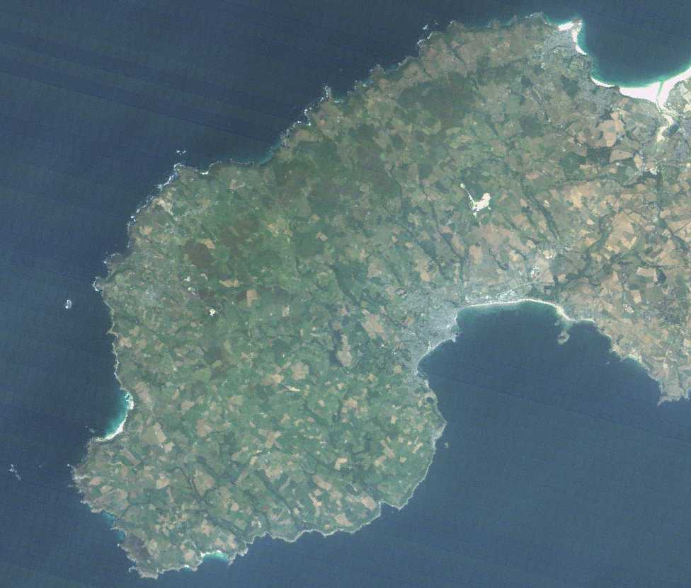