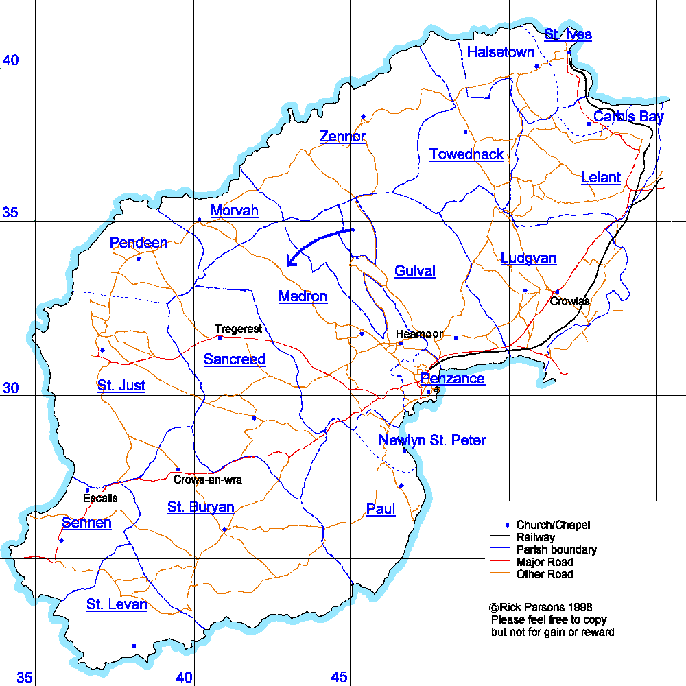
This new map is drawn as accurately as possible (but freehand) with reference to the 1" Ordnance Survey Land’s End sheet 151 revised 1905. The original has the advantage of showing (civil) parish boundaries and being more in tune with your research than modern maps. The features shown are limited to those useful for family history research; at present this is only the coastline, parish boundaries, largish roads and churches. I have had to draw some items with a little imagination. The last half mile up country is off the boundary of the original sheet; the boundaries of the modern parishes (Carbis Bay, Halsetown, Newlyn St. Peter and Pendeen) were not shown; the streets in Penzance were far too complex, this will be the subject of a future map; the National Grid was not defined until 1938, I have added the 5km lines on the main map and 1km lines on the detailed parish maps.
The parish names look like links. One day they will all be connected to more detailed information and parish maps. Only some of them work at the moment [*watch this space*]. These larger scale maps show settlements, mines, lesser roads and the 1km grid lines. I am open to suggestions for useful additions.

[St. Buryan] [Gulval] [St. Ives] [St. Just in Penwith] [Lelant] [St. Levan] [Ludgvan] [Madron] [Morvah] [Paul] [Penzance] [Sancreed] [Sennen] [Towednack] [Zennor]