- Statistics
- “Online Parish Clerk”
- Links
- The Deanery of St. Buryan (1300–1864)
- Protestation Return (1642)
- Tonkin’s Natural History of Cornwall (1739)
- Lysons’ History & Topography (1814)
- The Topographical Dictionary of England (1831)
- The Tithe Apportionment (1838)
- The abolition of the Deanery of St. Burian (1850)
- Kelly’s Directory (1856)
- Blight’s Churches of West Cornwall (1864)
- Lake’s Parochial History (1868)
- Kelly’s Directory (1873)
- Kelly’s Directory (1883)
- Kelly’s Directory (1893)
- The Cornish Magazine (1898)
- Detailed map of the parish (33K)
- The Parish in Context (44K)
- Gazetteer
- Picture Gallery
- Baptism Registers (index 1694–1812, index 1813–70, index 1871–1900)
- Marriage Registers (transcript 1694–1905)
- Burial Registers (index 1694–1812, index 1813–1920, transcript 1813–1906)
- Monumental Inscriptions
- Methodist Chapels
- Census 1841
Some records of the manors and mines shown on the detailed map are available for study.
Statistics
With the current boundaries the area is now 2,402 acres plus
3 acres of water and 31 of foreshore [![]() GENUKI 1997]. In 1868, Polsue had very
similar figures and stated that there were 2328 acres. In 1817
there were just 84 houses. The population of St. Levan has
varied little over the years with a small surge at the
beginning of the C20th.
GENUKI 1997]. In 1868, Polsue had very
similar figures and stated that there were 2328 acres. In 1817
there were just 84 houses. The population of St. Levan has
varied little over the years with a small surge at the
beginning of the C20th.
| Year | Population | Year | Population | Year | Population |
|---|---|---|---|---|---|
| 1801 | 400 | 1901 | 726 | ||
| 1811 | 434 | 1992 | 520 | ||
| 1821 | 490 | 1993 | 530 | ||
| 1831 | 515 | 1994 | 515 | ||
| 1841 | 531 | 1995 | 520 | ||
| 1851 | 502 | 1996 | 540 | ||
| 1861 | 447 | 1997 | 540 | ||
| 1871 | 536 | 1998 | 520 | ||
| 1881 | 584 (583) | 1981 | 485 | ||
| 1991 | 525(526) |
The later figures were obtained from from the ![]() Country Socio-Economic Statistics of St.
Levan civil parish.
Country Socio-Economic Statistics of St.
Levan civil parish.
Online Parish Clerk
A new (Jan 2001) initiative that has started in Cornwall is
the ![]()
 Online
Parish Clerk. One person is encouraged from the CORNISH-L
or CORNISH-GEN-L mailing list to be the custodian of historical
records, including transcripts of registers, for each parish
and will supply extracts to researchers as they need them. This
person may be geographically distant from the parish, but their
heart will be there. Parish information
Links
![]() SOSKernow (friends of Cornwall) have a
SOSKernow (friends of Cornwall) have a
![]() detailed history of St. Levan church.
detailed history of St. Levan church.
There is a website about the ![]() Penberth Valley which includes the
surrounding area including St. Levan church.
Penberth Valley which includes the
surrounding area including St. Levan church.
The Museum of Submarine Telegraphy is at Porthcurno.
Paul Stephens’ ![]() Panoramas includes an incredible 360° view from
Porthcurno Beach.
Panoramas includes an incredible 360° view from
Porthcurno Beach.
See also the general West Penwith Links.
Tonkin’s Natural History of Cornwall—1739
The following description is quoted from [Tonkin 1739] and must be read in the context of that date. The extract is taken from [Polsue 1868]. Other extracts are available online.
S. Levan is situated in the hundred of Penwith, and is bounded to the west by the ocean; to the north by Sennen; to the east by S. Burian; to the south by the mouth of the Channel.
This parish taketh its name from the saint to whom the church is dedicated, S. Levine.
It is a daughter church of S. Burian, farming part of the deanery of S. Burian.
Lysons’ History & Topography—1814
The following description is lifted directly from [Lysons 1814]. It must be read in the context of that date.
St. Levan, in the deanery and in the west division of the hundred of Penwith, lies about eight miles south-west of Penzance, and about three miles south-east from the Land’s-end. The principal villages in this parish are, Bosistow, Raughton, commonly called Rafton, Trebean, Trengothal, and Treryn or Treen. Raugton and Bosistow, both some time seats of the Davies family, and the latter, at an earlier period, of the Bosistows, are now farm-houses. Treryn of Treen castlel is in this parish. In this parish is St. Levan’s well, with an oratory; and at the distance of about a quarter of a mile, the site of an old chapel, called Port-chapel; and a mile to the eastward, that of another, called Chapel-Curnow.

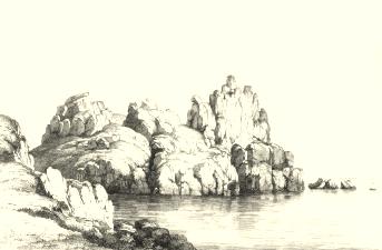
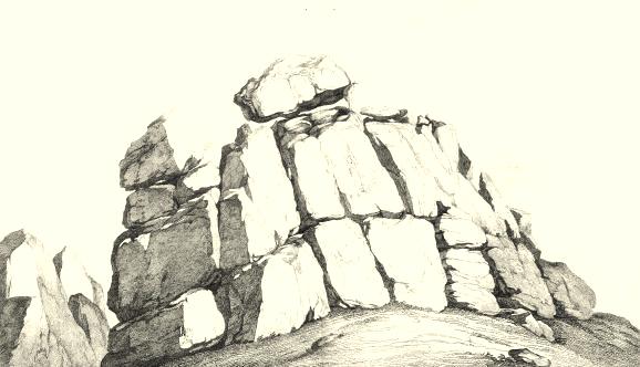
Castle Treryn in Cornwall

Rocks at Castle Treryn with the Logan Stone
l See p. clxxxiv. [plates above]
Additions and Corrections
The barton of Raughtra or Raftra (the name of which, as well as that of the village, is erroneously printed Raughton or Rafton) and that of Bosistow, belong to farmers by whom they are occupied.
Topographical Dictionary of England—1831
The following is from [Lewis 1831] and must be read in the context of that date.
LEVAN (ST.), a parish in the hundred of Penwith county of Cornwall, 9 miles (S.W.) from Penzance, containing 490 inhabitants. The living is a perpetual curacy in the peculiar jurisdiction and patronage of the Rector of St. Burian. Overhanging the sea, at the western extremity of the parish, are the celebrated rocks, or lofty piles of granite, called Castle Treryn, on the pointed summit of one of which the remarkable block, termed the Logan, or Rocking Stone, supposed to weigh about ninety tons, is so nicely ballanced, as to be moved to and fro by a single individual. In 1820, though considered almost the greatest curiosity in Cornwall, some sailors dislodged this immense mass, and precipitated it into the abyss below; but this mischievous act exciting a general feeling of indignation throughout the country, steps were shortly afterwards successfully take to replace it in its old position. There are a well, called St. Levan’s, and an ancient oratory in the parish.

 Webmaster